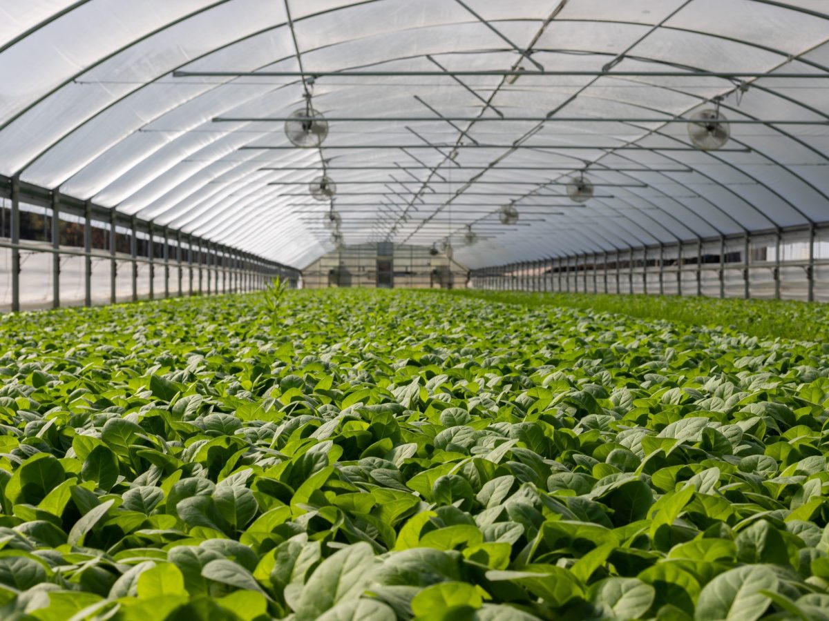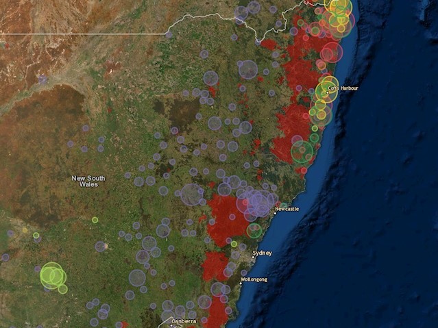

Challenge Australia’s protected cropping sector—encompassing glasshouses, shade houses, polytunnels, and nets—has been rapidly expanding, but until recently, there was no comprehensive, centralised data on the distribution, scale, or types of systems nationwide. This lack of visibility hindered efforts in yield forecasting, infrastructure planning, workforce coordination, disaster response, and biosecurity preparedness.
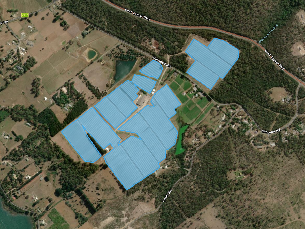
Solution The project leveraged a range of data sources—including existing spatial layers, industry data, high-resolution remote sensing imagery, and on-ground validation—to develop a comprehensive and accurate database of PCS infrastructure. The project team will work closely with Protected Cropping Australia (PCA), corporate farms, and small growers to ensure the final outputs are practical, accurate, and respectful of privacy requirements. No personal, confidential, or commercially sensitive information will be collected, published, or displayed. Instead, the focus will be on delivering spatially relevant, publicly accessible data that supports broad industry and government use.
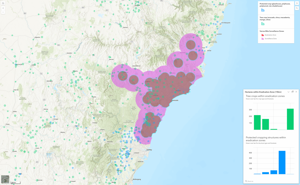
Impact The national PCS map serves as a foundational dataset supporting a wide range of critical applications. It will inform logistical decisions related to transport, labour distribution, market access, and agricultural infrastructure. The data will also assist in developing responses to food security issues, drought, and natural disasters, and will be instrumental in biosecurity planning. Furthermore, it will underpin federal initiatives focused on soil health, carbon accounting, and climate resilience, making it a valuable asset across multiple sectors of the agrifood landscape.
View the PCS Dashboard here.
PCS maps/apps and other location-based tools which support the map can be found here
You can view the final report and papers from these links